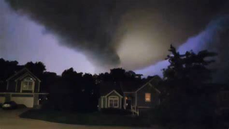
The National Weather Service in Pleasant Hill has now determined that a tornado outbreak occurred as four twisters ripped through the Kansas City metro early Wednesday morning.
The assessment comes as officials reviewed radar and damage on the ground from the storms that also left tens of thousands without power.
As of Thursday, hundreds remain without power.
It is the largest tornado outbreak in the metro in recent years and left many surprised as the twisters caused sirens to sound out across several counties.
Video showed a dangerous large funnel cloud moving north of Kansas City as lightning flashed and the wind whipped around large trees.
One tornado, passing through Lee’s Summit, was filmed by Jay Phillips from his front porch in Greenwood.
The storm caused damage to downed trees, many downed a power lines and caused loose items to take flight. The storm caused no significant structural damage, Lee’s Summit Fire Department officials said.
The Weather Service regional office in Pleasant Hill says reports show an EF1 tornado spun up in Johnson County, and stayed on the ground for roughly 14 miles, crossing the state line into Jackson County, Missouri.
Officials report 100mph maximum winds as part of this storm, and a 125-yard width.
Damage surveyors have been in Independence and Buckner since Wednesday to examine damage.
The National Weather Service said preliminary damage report from near Buckner was that it was an EF2 tornado with 115 mph max winds. It cut a 9-mile path.
–Metro Voice


