Local forecasters get do-over as Winter Storm Warning issued
Local weather forecasters got it horribly wrong during the last winter storm warning. Just weeks ago they forecast up to 12 inches of snow locally yet just 2-4 fell across most of the greater Kansas City area.
They’ll have a chance to get it right tonight as they predict snow and ice totals from a storm expected to move in during the early hours on Thursday.
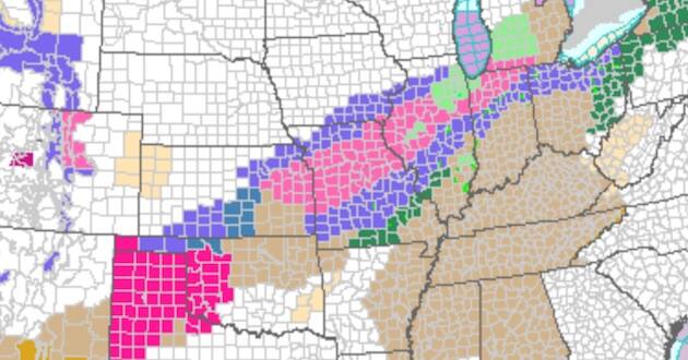
The National Weather Service has officially put the Kansas City area under a winter storm warning beginning at midnight Wednesday.
READ: Midwest Christian College Fair is Feb. 26
The warning will be in effect until 6 p.m. Thursday.
The warning said that there is expected to be heavy mixed precipitation, snow accumulations of four to seven inches, ice accumulations of up to one-tenth of an inch and winds gusts as high as 40 miles per hour.
The storm could bring additional inches if the comma head of the system wraps back around and hangs over the area for extended periods of time.
“Patchy blowing snow could significantly reduce visibility,” the warning said about travel. “The hazardous conditions could impact the morning or evening commute.”
The counties affected are Shawnee, Douglas, Jefferson, Osage, Franklin, Anderson, Coffey, Lyon, Wabaunsee, Miami, Linn, Leavenworth, Wyandotte and Johnson Counties on the Kansas side and Clinton, Caldwell, Livingston, Linn, Macon, Platte, Clay, Ray, Carroll, Chariton, Randolph, Jackson, Lafayette, Saline, Howard, Cass, Johnson, Pettis, Cooper, Bates and Henry Counties on the Missouri side.
–Metro Voice