
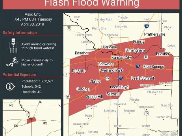
The National Weather Service (NWS) in Pleasant Hill has issued a Flood Warning today and tonight for a large portion of western Missouri and eastern Kansas including Kansas City, Overland Park, Lee’s Summit, Independence and other suburbs, as well as southeastern Kansas and large portions of Missouri.
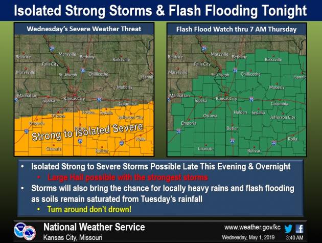
A warning for severe and tornadic weather extends from Missouri’s southern border with Arkansas north to the southern portions of the Kansas City Metro including Cass County through Wednesday night into Thursday.
The NWS says that torrential rains have saturated the soils across the area and, with heavy rain continuing, could continue severe flooding through Thursday night.
In addition to southern Kansas City, NWS Springfield meteorologist Mike Albano says the watch area includes Springfield, Branson, Joplin, Lebanon, Monett and Carthage.
“This is one of the most severe weather days we’ve seen in awhile here across the Ozarks,” Albano says. “All modes of severe weather will be possible, including damaging winds, some large hail and possibly some tornadoes as well.”
Albano says super cells have been popping up in far southwest Missouri.
“We’re looking at a long, kind of a long period here of severe weather as we go into the afternoon into the overnight,” says Albano.
The NWS says apple-sized hail is also possible tonight, along with 70 mile-per-hour winds. Strong storms and heavy rain are expected to spread across Kansas City tonight into Thursday with chance of severe weather each day through the middle of next week.
As for the weekend, a high pressure ridge finally builds into the area Saturday and allows the region “to dry out as we go into the weekend with Saturday looking like a great spring day with highs in the lower 70s and dew points in the 40s and 50s,” the NWS states.
AS for next week, the NWS says that severe weather is likely to fire-up “nightly going into next week. This pattern indicates the early portion of next week is likely to be active with multiple chances of rainfall everyday and a favorable severe weather set up on Wednesday.”
–Dwight Widaman