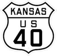
40 Highway: The Historic Road That Connected Missouri, Kansas and Beyond
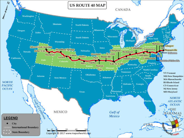
U.S. Highway 40 stretches from Atlantic City, New Jersey all the way to Park City, Utah. But one of its most iconic stretches lies in the Midwest, crossing Missouri and Kansas. This section of highway has a rich history, serving as a key transportation route for over a century.
We have all heard and seen the historic Route 66, the road that ran from Chicago to California, much of which has been gobbled up by the Interstate Highway System, including I-44, but the highway system is more than one road, and, in fact there is magic to the numbers.
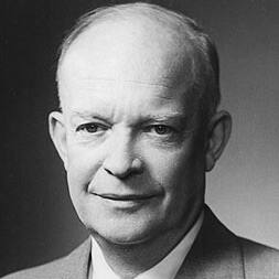
Like the Interstate Highway System begun under President Dwight D. Eisenhower, the even numbered U.S. highways run east and west. For US Highways, the lower numbered highways are in the north, as opposed to the Interstates, where I-10 is in the south.
However, US Highways ending in zero, such as 40 and 50, were planned as transcontinental highways running from coast to coast. Because that might cause confusion in the center of the country where Interstates and US Highways might run on top of each other, there is no Interstate 50 or 60.
The beginnings of US 40 Highway
The origins of 40 Highway (Missourians and Kansans generally put the number first), date back to the early 19th century. The route may have first served as a footpath used by Native Americans of the region including the Osage and other tribes.
Known as the Osage Trace, this trail network connected settlements and hunting grounds long before early American settlers and arrived.
In the 1830s, the U.S. military constructed a road following part of the Osage Trace to connect the frontier from Ft. Leavenworth to Ft. Scott, Fort Hays, Abilene, Kansas and other territorial forts and points, most of which are on US 40 or I-70.
This early military road opened up central and western Missouri and eastern Kansas to increased settlement in ensuing decades. In fact, after 1820 and the Missouri Compromise, the territory known as Kansas included Arapaho County, the area today known as Colorado.
We tend to focus on the border before the Civil War, but Fort Hays was the travel point for all the development of western forts in Nebraska and the Dakota Territory, as well as Colorado where gold was discovered in 1858 and 1859.
When the U.S. Highway System was established in 1926, much of this old military road was paved over and designated as U.S. Route 40. It immediately became an important route for coast-to-coast travel.
The highway that connected towns, big and small
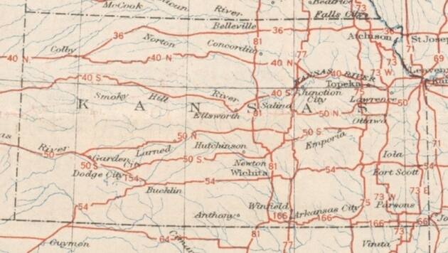
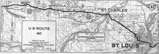
In subsequent years, Route 40 connected key cities in Missouri and Kansas. It runs from St. Louis across the center of the state, passing through Columbia, Booneville, Blue Springs and Kansas City before crossing the Kansas state line. From there it continues through Lawrence, Lecompton, Topeka, Salina and smaller towns like Weskan before exiting Kansas to the west.
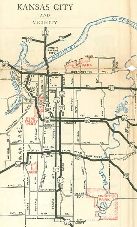
In Kansas City, there are three US Highways running east and west, 40, 50, and 56, but it was US Highway 40 that came to be known as the Main Street of America. It was one of the first US Highways created running all the way to San Francisco, and earning its transcontinental “0”. However, the western portion of US 40 became I-80 in Utah, but the number was never changed.
During the Dust Bowl migration of the 1930s, U.S. 40 served as a main route west for displaced families. News accounts at the time showed thousands heading to California, literally packing everything they owned into their cars. Route 40 was crucial to that mass exodus from the “Plains.” Many of the Dust Bowl travelers coming from Oklahoma to the south, followed the cattle roads north into Kansas then following US 40 west, moved on to California. It probably should be noted that 1934, 1935, and 1936 were some of the most brutal in history, when the temperature in Kansas City hit 113 degrees and there were over 50 days of 100 degree plus heat, a record that still stands.
Part of the war effort and Americana
The roadway also played an important role during World War II. With railway traffic diverted for the war effort, Route 40 became a key means to transport materials and troops across Missouri and Kansas.
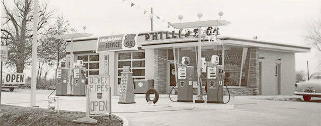
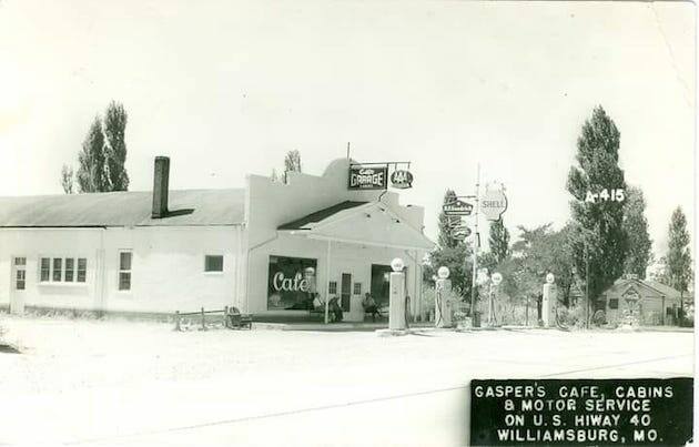
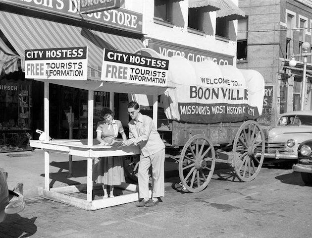
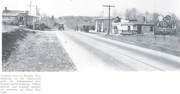
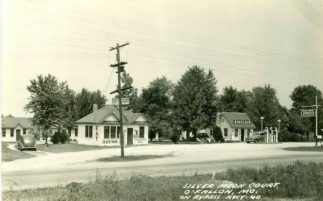
After the war, growing automobile tourism led to the rise of roadside attractions along U.S. 40. Travelers began seeing things like giant statues or stacked bottles to catch drivers’ attention that would eventually mark part of the quintessential road trip experience for millions of Americans. Some of them still exist today, the Largest Prairie Dog, the large ball of twine, and a host of others near the towns of Oakley, Quinter, and Wakeeny, (as it turns out, Wakeeny is halfway between Kansas City and Denver) where there are two saloons offering that half inch prime rib that you can’t miss. In fact, it is the western Kansas segment of the Interstate between Oakley and Colby that, completed in 1970, represented the longest completed section of Interstate, 424 miles across Kansas in any state.
The birth of the Interstate System
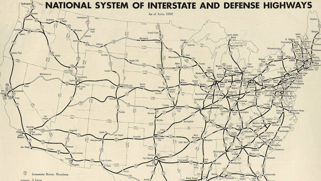
The coming of the Interstate Highway System in the late 1950s and 1960s transformed Route 40 yet again. I-70 was constructed closely paralleling U.S. 40, reducing traffic but also bypassing many towns.
 According to the Kansas Historical Society, the initial plans for the Interstate highway system in Topeka did not include a freeway through downtown and 40 may have been saved. Instead, US 40 would have bypassed the city to the north via the Westgate bridge and US 24. This proposal was scrapped when the Downtown freeway segment was added and designated as part of I-70 and US 40.
Sadly, the road is all but gone in St. Louis, having become several sections of different Interstates.
Historians say it fundamentally changed the tourist economy in a lot of those small towns.
Still an iconic drive, when you can find it
Though sections have been decommissioned over time, today’s drivers can still access much of the original U.S. 40 route that connected Missouri and Kansas.
So next time you find yourself on an interstate, consider taking a scenic drive along America’s early paved highways. U.S. 40 across the Show-Me-State and Sunflower State offers a glimpse into the past addressing topics like westward expansion, the Dust Bowl, and 20th century driving vacations.
 Take the trip through central Missouri as it passes through Booneville or north of I-70 a few miles east of Kingdom City. Or through Blue Springs through Kansas City, passing the old gas stations or restaurants like Stephenson’s and then on to Kansas City, Kansas through Leavenworth County, and on to Lawrence and the original territorial capital of Kansas in Lecompton and then through Topeka.
But take your time and relish the memories the pavement holds. Today, 40 Highway continues to be a historic old road that tells the story of American transportation and culture through the region and beyond.
–Dwight Widaman and Bob White
Additional resources:
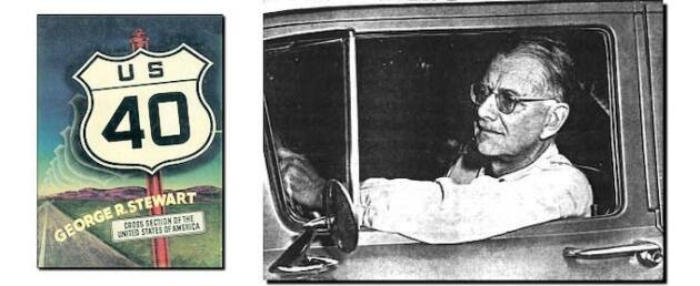
George R. Stewart, an English professor at the University of California crossed the country four times between 1949 and 1950. He took more than 1,000 medium-format photographs of everyday life along the highway. The result of his work was U.S. 40: Cross-Section of the United States of America (1953: Houghton-Mifflin). Famous U.S. 40 inspired several adaptations and follow-up works including:
- In 1957, George R. Stewart followed U.S. 40 with N.A.1, a two-volume book that examines life along the Panamerican Highway between the Arctic Circle and Costa Rica.
- German filmmaker Hartmut Bitomsky adapted the German language edition of U.S. 40 for his 1981 3-hour documentary Reise in Amerika – Highway 40 West.
- Thomas R. Vale and Geraldine R. Vale’s partial update U.S. 40 Today (University of Wisconsin Press, 1983).
- Thomas R. Vale and Geraldine R. Vale’s Western Images, Western Landscapes: Travels Along U.S. 89 (University of Arizona Press, 1990).
- Amiland, a 2008 German documentary by Vojtech Pokorny and Florian Schewe that uses U.S. 40 as the framework for looking at life in the United States.